18 Nov Marking the trails of the Alpes-Maritimes
During this interview, you can find out how the marking of the trails of the Alpes-Maritimes is taken care of by our team.
Hello Cyril, in a few words what is trail marking?
The mark-up is above all a question of safety and maintenance. You should know that it is only the marked trails that are maintained and cleared an additional clue when you evolvez in the trails of the Alpes-Maritimes.
These tags are standardized with a size of 60mm x 120mm and bright yellow in color. Moreover, painting is not chosen at random. We have selected a paint adapted to the x-middle exterior with a high UV resistance. It sounds simple but it is an important detail to ensure a good longevity of the trails of Alpes-Maritimes. We also have specific rules on the distance between the trail and its legibility. For example on a track it will be every 400 meters while on rough terrain it will be “to see”. It also depends on whether or not crosses are present.
Do you have a special team for this kind of work?
CAIRN Expe is above all a company that I manage alone so I travel on all missions whether it is those concerning the signage poles of hiking or the markup.
But we must not forget that I am well surrounded, I am in contact with Fabien, who almost plays the role of partner on these different missions where we always travel in pairs.
Depending on the amount of work I can also call Olivier who is more in demand as a guide during survival courses,or even call on Xavier, the new recruit when he does not paint himself! (laughs)
How is a mission to mark the trails of the Alpes-Maritimes?
There are three stages of a trail marking mission:
- The order made by the department that will tell us precisely the area and the portions of trails that the officers of the Departmental Council wish to tagr
- Preparation: We usually have orders of 100 to 150km. Before any action it is necessary to organize the area into sectors and plan the different days. Then before each departure we prepare our equipment:
- A backpack with water and mountain-friendly belongings(k-way, sweater)
- A rescue kit
- A loaded mobile phone
- A metal brush
- A machete
- A big grey pencil
- A rag
- A stencil
- A grey paint bomb (to erase misplaced marks)
- And finally a pot of paint and a brush
- The operational part on the ground!
In general a few figures could sum up a typical day of trail marking ?
So we sometimes have large variations depending on the area for example:
- If the area has many intersections
- If the area is wooded or rocky
- Whether the previously done markup is correct or not
- The overall legibility of the trail
But we can make some averages with:
- 4 to 5 km of marked trailsper person, on a mission day
- More than 120 brands per team member on average over one day
- From a few tens of meters to more than 1000 meters of vertical drop
- A 6am departure at dusk!
But how are these tags in the end made?
Nous sommes confrontés à 3 cas de figure :
- In urban areas we often useyellow stickers that we have on electric poles, barriers or streetlights.
- In the wild we have either the trees or the rocks. We always prefer trees because their height makes it possible to distinguish the brand from further afield!
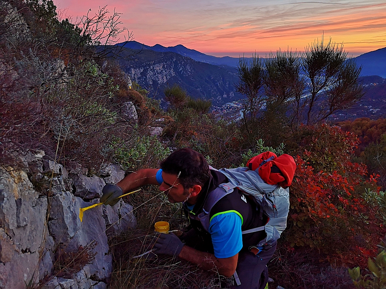
- In this case we begin to bark the tree being careful not to make it bleed (when the sap comes out of the tree). Don’t go to the top. Then we make a pencil mark using our stencil and we stitch the tree at the marks so as not to protrude and the paint does not leak. Then we paint!
- In the other case we start by brushing the rock, then we make the marks with stencil and finally we paint
Any tips for hikers?
Especially the main thing is to plan your hike, you have to plan with a map your route even if it lasts only a few hours. A simple tip is to write down the number of each sign you will come across and always carry a map and compass. By holding the number of the poles you will never get lost and the tags whether they are PR or GR will guide you on the trails.
Remember that the weather in the mountains is very changeable, try to look at the bulletins before leaving and always leave with warm clothes.
Finally don’t neglect your equipment! A good pair of shoes, a bag with water and a small emergency kit or even sticks.
What are we crossing red and white beacons?
These are the GR beacons that identify walking trails that travel in several days, even several months! These beacons are managed by the French Hiking Federation.
We only take care of the PR trails that are the responsibility ofthe department of the Alpes-Maritimes,with orders from agents who managemunicipalities withinit. This is the PDIPR, it is the Departmental Plan of Walking And Hiking Routes.
One last word?
Get out of your house, enjoy the great outdoors, nature andseve the beacons according to your desires, to discover the sumptuous landscapes of the Alpes-Maritimes and the Parc du Mercantour! You won’t be disappointed.
Sorry, the comment form is closed at this time.